An API well number is the unique identification code assigned to every oil and gas well drilled in the United States [1]. It runs from 10 to 14 digits, and no two wells anywhere in the country share the same one [1]. To look one up, read the leading digits for the state and county, then query the well in a state database or a multi-state map [2]. Operators and regulators lean on that number to tie a well’s permit to its later production and emissions filings [2]. On TetraSoft Atlas, our subscription platform for oil and gas records, every well shows its API-10 number beside the operator and its production history [3].
Quick Answer: An API well number is a unique 10 to 14 digit code for a single oil and gas well [1]. Read the first digits for the state and county, then look the well up in a state database, or find it on TetraSoft Atlas, where every well’s record shows its API-10 [2].
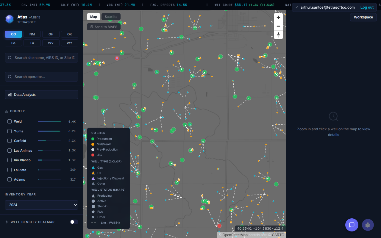
Atlas maps about 2.7 million wells across eight states, each one clickable to its full record.
What Is an API Well Number?
An API well number is a permanent ID that a state agency assigns to a well when it issues the drilling permit [2]. Its core is ten digits in fixed blocks: two for the state, three for the county, and five for the individual well [1]. Those first ten digits are the API-10, the form most databases store and display [1].
Up to four more digits can follow, for a full API-14, but only when a well needs them [1]. A simple single-bore well stops at ten, while wells with sidetracks or extra completions carry the 12- or 14-digit forms [1].
State codes run in alphabetical order, from 01 for Alabama to 49 for Wyoming, then 50 for Alaska and 51 for Hawaii [1]. The American Petroleum Institute standardized the scheme in its D12A bulletin [1]. The full set of codes fits in one compact table.
| Code | State | Code | State | Code | State |
|---|---|---|---|---|---|
| 01 | Alabama | 18 | Maine | 35 | Oklahoma |
| 02 | Arizona | 19 | Maryland | 36 | Oregon |
| 03 | Arkansas | 20 | Massachusetts | 37 | Pennsylvania |
| 04 | California | 21 | Michigan | 38 | Rhode Island |
| 05 | Colorado | 22 | Minnesota | 39 | South Carolina |
| 06 | Connecticut | 23 | Mississippi | 40 | South Dakota |
| 07 | Delaware | 24 | Missouri | 41 | Tennessee |
| 08 | District of Columbia | 25 | Montana | 42 | Texas |
| 09 | Florida | 26 | Nebraska | 43 | Utah |
| 10 | Georgia | 27 | Nevada | 44 | Vermont |
| 11 | Idaho | 28 | New Hampshire | 45 | Virginia |
| 12 | Illinois | 29 | New Jersey | 46 | Washington |
| 13 | Indiana | 30 | New Mexico | 47 | West Virginia |
| 14 | Iowa | 31 | New York | 48 | Wisconsin |
| 15 | Kansas | 32 | North Carolina | 49 | Wyoming |
| 16 | Kentucky | 33 | North Dakota | 50 | Alaska |
| 17 | Louisiana | 34 | Ohio | 51 | Hawaii |
The county digits pin the well to one county, fixed from its surface location rather than the bottom of the bore [1]. A horizontal well that runs across a county line keeps the code of the county where it starts [1]. Its bottomhole can sit elsewhere, yet the API number holds [1]. Operators new to the format often expect the number to follow the producing formation, not the wellhead.
How do you read the digits of an API number?
You read an API number left to right, from the widest location down to the single well [1]. Take the Oklahoma well 3513722789 [3]. The 35 marks Oklahoma, the next three digits point to Stephens County, and the final five identify that one well [2].
The last four digits handle wells that are not simple single bores [1]. The first extra pair marks a sidetrack drilled off the original hole; the second pair records a later recompletion [1]. Take that same well 3513722789: a first sidetrack makes the 12-digit form 351372278901, where the 01 identifies the sidetrack [1]. A recompletion appends one more pair, so the 14-digit form reads 35137227890101 [1].
How do you find which county a well is in from its API number?
You find the county in digits three to five, read within the state named by the first two [4]. The five digits after it identify the well, not a place, and the standard gives their sequence no meaning [4]. The number carries no coordinates, lease or survey section, so the exact location comes from the state’s well record [2].
Take 42-317-33982. The 42 is Texas [1], and 317 is Martin County [3]. The well’s Railroad Commission record, as mapped in Atlas, puts the wellhead at about 32.51° N, 101.72° W [3]. The number named the county, and the record supplied the point.
One county code from each state Atlas covers shows the pattern [3].
| API prefix | State | County |
|---|---|---|
| 05-123 | Colorado | Weld |
| 30-025 | New Mexico | Lea |
| 34-157 | Ohio | Tuscarawas |
| 35-137 | Oklahoma | Stephens |
| 37-125 | Pennsylvania | Washington |
| 42-317 | Texas | Martin |
| 47-103 | West Virginia | Wetzel |
| 49-037 | Wyoming | Sweetwater |
For any other county, paste the full number into the decoder at the top of this page, or find it in the API county codes by state tables. Both name the county from the same table.
A few codes break the pattern. For a well that deviates into a neighboring county, a few state regulators assign the county of the producing zone instead of the surface location [4]. Wells in state or federal offshore waters carry a pseudo-county code rather than a county [4]. Alaska numbers its wells by USGS quadrangle, not by borough [4].
How Do You Look Up a Well by Its API Number?
You run an oil well lookup or gas well lookup in the state agency database that issued the API number, matched by the state code [2]. Each state runs its own well system keyed to those numbers [2]. Texas wells sit in the Railroad Commission of Texas records, and Colorado wells sit in the Energy and Carbon Management Commission (ECMC) database [2]. New Mexico, Oklahoma, Ohio, Pennsylvania, West Virginia, and Wyoming each run an equivalent agency system [2].
A well API number lookup takes one field. Enter the API number in the agency’s well search, and the record returns the operator, location, status, and permit history [2]. Because the number never changes, it stays valid even after a well changes hands [2].
Which agency database matches each state code?
For an API number lookup, match the leading two digits to the agency that runs that state’s wells [2]. Code 05 routes to Colorado’s ECMC, and 35 routes to the Oklahoma Corporation Commission (OCC) [2]. Each agency runs a public well search that accepts the API number [2].
State portals format the number in different ways [2]. Some take the full 10 digits with or without dashes, and Texas records often drop the 42 state prefix [2]. Keep the full API-10 on hand, and you can match a well in any state system.
The same number reaches past the permit record, threading through production and enforcement filings held in separate systems [2]. For a worked state example of those records cross-linked, see our COGCC (Now ECMC) Oil & Gas Data, Cross-Linked and Faster Than the State Portal.
Where Can You See Wells and Their API Numbers Across States?
TetraSoft Atlas maps millions of wells across eight states and shows each well’s API-10 on its record [3]. The map covers Colorado, Texas, New Mexico, Oklahoma, Wyoming, West Virginia, Pennsylvania, and Ohio, and TetraSoft is actively adding more states over time [3]. Together those states hold about 2.7 million wells, with Texas alone about 1.2 million. Search runs state by state. In Texas an API number goes straight to the well. In the other states you find a well by its name or operator and read its API-10 on the record.
You locate a well on the map, or by its name and operator, then open its record [3]. The panel leads with the API-10 number, next to the operator and the well’s status, with production and gas composition a tab away [3]. For a single-state view of the same idea, see our Colorado Oil & Gas Map: Emissions and Enforcement Data.
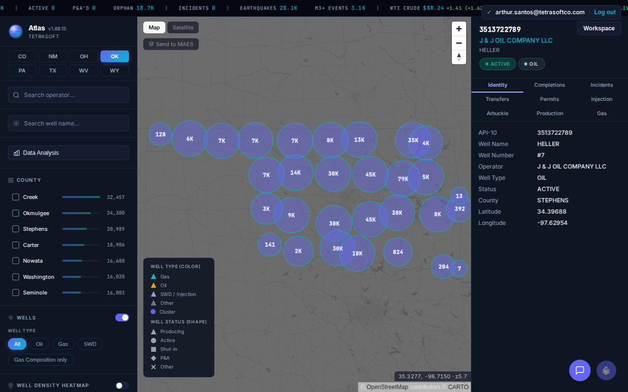
An Oklahoma well record in Atlas: the API-10 number leads, beside the operator and county. [3]
Frequently Asked Questions
How many digits is an API well number, and why does the length vary?
An API well number holds up to 14 digits, but the first 10 do the everyday work [1]. That API-10 already names one wellbore, which is why most databases display and search on it [1]. The length varies because the extra digits are optional, added only for wells with sidetracks or multiple completions [1].
Does an API well number tell you the exact location of a well?
No. The number identifies the state and the county, and nothing finer [4]. The coordinates, lease and survey location sit in the well record kept by the state agency, which you find by searching the full number [2]. A multi-state map such as Atlas plots the well from that record [3].
Why does a county code in an API number match no county?
It usually marks an offshore pseudo-county, which covers state or federal waters rather than land [4]. Alaska is the other exception, since it numbers wells by USGS quadrangle instead of borough [4]. A state can also add codes, as California did when Kern County ran out of well numbers [4].
Does an API well number ever change?
An API well number stays fixed for the life of the well [2]. A change in operator or ownership does not alter it [2]. That permanence lets the number act as the join key across separate agency systems [2].
Is an API number the same as a drilling permit number?
No, the two identifiers serve different roles [2]. A drilling permit number tracks the application to drill, and each state formats it differently [2]. The API number identifies the physical well and follows the national format in every state [1]. You use the API number, not the permit number, to match a well across agencies.
What does a state code above 49 mean?
Codes above 49 cover wells outside the original lower-48 numbering [1]. Alaska carries 50 and Hawaii carries 51, and higher numbers mark offshore federal waters [1]. The reading rule does not change, since the first two digits still name the jurisdiction [1].
Is the API well number being replaced by a US Well Number?
Not in practice yet [1]. The industry has proposed a longer US Well Number to fix format gaps and cover wells the old scheme cannot number [1]. State agencies still assign and publish the API number as the primary well identifier today. You look up wells by API number in every state system covered here [2].
A well’s records all trace back to one number, and Atlas puts wells from eight states on one map with that API-10 attached [3]. Start your free 7-day trial.
This post is for informational purposes only and does not constitute legal or compliance advice. Consult qualified legal counsel or a compliance professional for guidance specific to your operations and jurisdiction.
References
- American Petroleum Institute, Bulletin D12A well numbering standard (1968; 1979 revision), now maintained by the Professional Petroleum Data Management (PPDM) Association.
- U.S. state oil and gas regulatory agency well databases (RRC Texas, ECMC Colorado, OCC Oklahoma, and peer state agencies).
- TetraSoft Atlas, multi-state oil and gas dataset and product features. https://tetrasoftco.com/atlas-landing.html
- PPDM Association, The API Number Standard: An Identifier for Petroleum Industry Wells in the USA (2013), which replaced API Bulletin D12A (1979 revision). https://dl.ppdm.org/dl/836
Interactive tool
Decode an API well number
10, 12 and 14 digit forms all work. Nothing leaves your browser.
State codes follow the American Petroleum Institute D12A standard. County names come from US Census county FIPS codes, which match the API county code for onshore counties in the lower 48. Alaska and offshore waters use their own codes, so check those with the state agency.
Comments
0Share your thoughts. All comments are moderated before appearing.
No comments yet. Be the first to share your thoughts!