The Colorado Oil and Gas Conservation Commission (COGCC) was renamed the Energy and Carbon Management Commission (ECMC), and it is the same agency [1]. Colorado publishes its oil and gas wells, permits, and production through that agency, with emissions and enforcement held separately by CDPHE [1]. The state portal shows those records one lookup at a time, without the emissions or enforcement tied to each one [1].
TetraSoft Atlas, our subscription platform for oil and gas records, maps the same COGCC, now ECMC, records and cross-links them in one view [2]. Each well, permit, and facility carries its production, emissions, enforcement history, and peer benchmarks [2]. It carries the current ECMC data and the legacy COGCC records, refreshed monthly [2].
Quick Answer: Colorado has about 37,000 wells, 790 drilling permits, and over 21,000 spill records published by COGCC, now ECMC. Atlas maps them and cross-links them with emissions and enforcement, refreshed monthly [2].
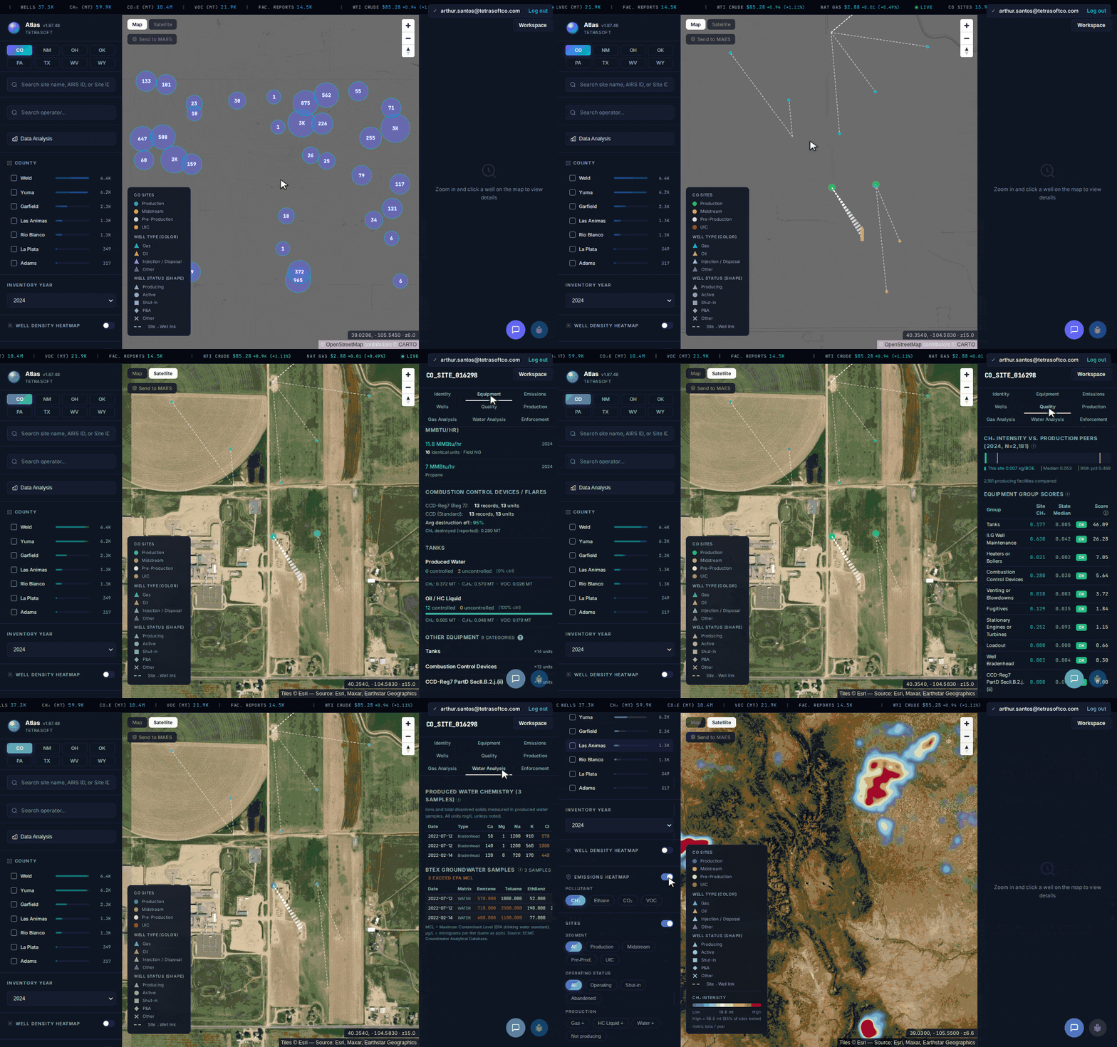
The same COGCC and ECMC records you would hunt through the state portal, searched and cross-linked in Atlas: from statewide wells down to one facility’s production, gas composition, and emissions. [2]
Search COGCC Wells, Permits, and Production in One View
For a COGCC well search, TetraSoft Atlas finds any site or operator from the map’s search boxes, and any permit from its permit search [2]. You search sites by name or AIRS ID, operators by name, and permits by API number, permit number, or well name, instead of paging through the COGCC GIS, now the ECMC interactive map [2]. Every result opens the record with its full context attached [2].
Colorado drilling permits come with their approval and expiry dates [2]. Atlas lists active permits sorted by expiry, so you see what is current at a glance [2]. Production, spills, and contamination records sit on the same map [2].
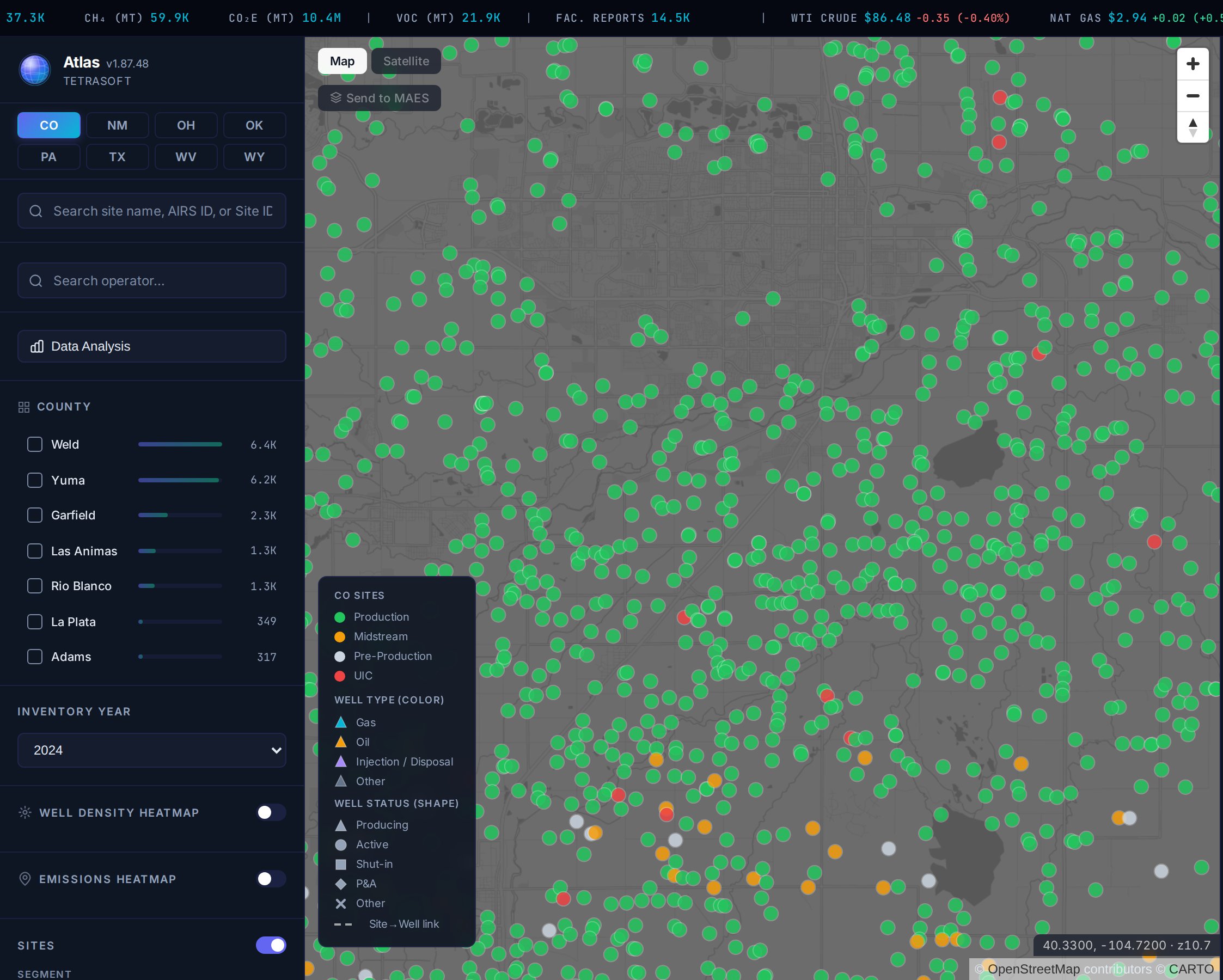
The DJ Basin in Atlas: hundreds of COGCC/ECMC facilities on one map, colored by type and status. Turn on the wells filter to see every well and which wells connect to each site. The state portal surfaces the same records one lookup at a time. [2]
Every Record, Connected to Its Emissions and Enforcement
The COGCC map, now ECMC’s, stops at the well and the permit [1]. Atlas adds the emissions, the enforcement history, and the peer benchmark for each site [2]. Alleged violations sit next to EPA ECHO evaluations and formal actions [3]. You also see where a facility ranks against its Colorado peers on methane [2].
COGCC Was Renamed ECMC. The Data Did Not Move.
The Colorado Oil and Gas Conservation Commission became the Energy and Carbon Management Commission [1]. The mandate expanded, but the well, permit, and production records carried over [1]. Atlas carries both the current ECMC data and the legacy COGCC records [2].
So an ECMC well search for old COGCC records still lands.
What the State Portal Cannot Show You
The state portal shows records one at a time; Atlas connects them in one view.
| Capability | The state portal | Atlas |
|---|---|---|
| Wells, permits, and production | Separate lookups | Cross-linked in one view |
| Emissions per site | Not shown | Shown |
| Enforcement history per site | Scattered | Tied to the facility |
| Peer benchmarking | Not available | Methane percentile versus peers |
| Multiple states | One at a time | Eight, one view |
| Time to an answer | Hours | Seconds |
| Official filing and system of record | Where operators file, and where the authoritative record lives | Maps the published data, not the system of record |
Every row above ships for Colorado today [2]. The records are the agency’s; the connections are what Atlas adds. For an official filing, or the authoritative document of record, you still use the ECMC portal, not Atlas.
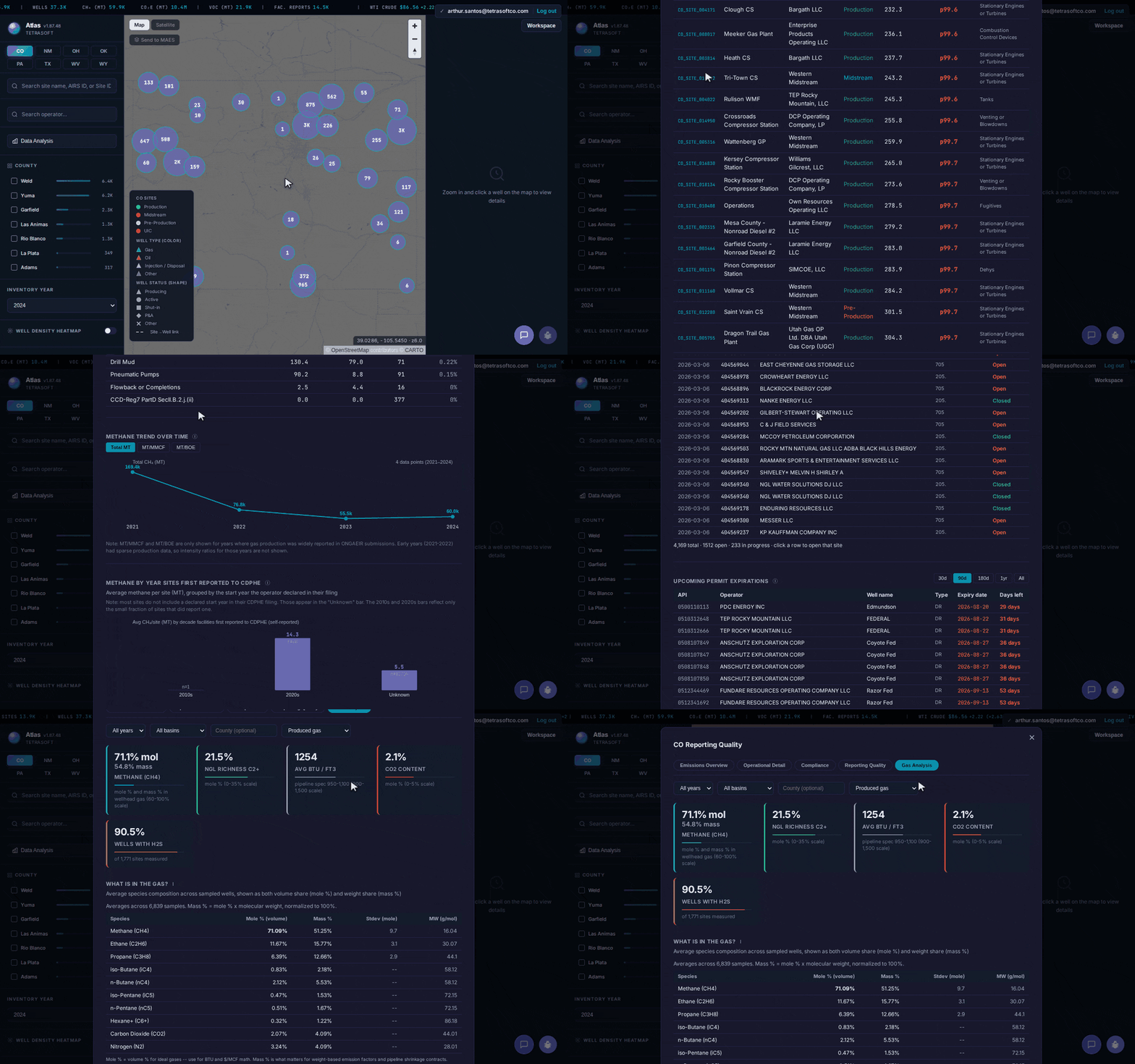
Beyond a single COGCC record: Atlas rolls the same ECMC and CDPHE data into statewide analytics, with operator rankings, flagged sites, enforcement, and gas composition. [2]
COGCC and ECMC Production Data, Well by Well and Site by Site
ECMC production data is published per well: the COGIS Production Data page takes a valid API number and lists monthly volumes by formation [4]. Each month shows oil produced and sold, gas produced, flared and sold, water volume and days produced [4]. That answers one well at a time, for readers who already hold its API number.
Atlas rolls the same Colorado oil and gas production data up to the site, the facility its wells belong to [2]. A site’s production tab lists annual oil, gas and water from 2020 onward, with monthly bars for each [2]. Where the operator’s ONGAEIR report also lists production, the tab sets the two figures side by side [2].
So production sits on the same record as the site’s emissions, enforcement and methane benchmark [2]. See how TetraSoft Atlas works, or compare plans on the Atlas pricing page.
Reach Any COGCC or ECMC Record in Three Steps
Getting to that view takes three steps [2]. First, start a free trial that runs for seven days [2]. Second, search your operator, filter to your county, or look up a single permit by API number [2]. Third, read the site’s full regulatory and emissions record on one screen [2].
The Colorado well search that took an afternoon on the portal takes a search box.
The Records Come Straight From ECMC and CDPHE
Atlas carries public records from ECMC (formerly COGCC) and CDPHE [1]. Atlas does not invent numbers; the map connects the records the agency already publishes, including operators’ annual ONGAEIR emissions filings. Atlas refreshes the Colorado data monthly and defaults to the latest reporting year [2]. You review the same current records the agency uses.
Beyond Colorado: Eight States on One Map
Colorado is one of eight states in Atlas [2]. You can open the same view for Texas, New Mexico, Oklahoma, Wyoming, West Virginia, Pennsylvania, and Ohio [2]. For the full Colorado picture, see Colorado Oil & Gas Map: Emissions and Enforcement Data.
Frequently Asked Questions
What does COGCC stand for?
COGCC stands for the Colorado Oil and Gas Conservation Commission [1]. It was the state agency that regulated oil and gas wells, permits, and production [1]. The agency has since been renamed ECMC [1].
Is COGCC now ECMC?
Yes. The Colorado Oil and Gas Conservation Commission (COGCC) was renamed the Energy and Carbon Management Commission (ECMC) [1]. ECMC is the same agency, with an expanded mandate and continuous records [1]. Atlas maps both the ECMC data and the legacy COGCC records [2].
How do I search COGCC or ECMC well and permit data?
Search Atlas by site name, AIRS ID, or operator, or look up a permit by API number, and open the record with its full context [2]. Atlas holds about 37,000 Colorado wells and 790 drilling permits in the current reporting year. Permits list their approval and expiry dates so you see what is active [2].
Can I see emissions and enforcement for a COGCC site?
Yes. Every facility shows its alleged violations alongside EPA ECHO evaluations and formal actions [3]. Those records sit next to the site’s emissions and its methane percentile among peers [2]. You read the regulatory record and the emissions record together, not in separate systems.
How much does TetraSoft Atlas cost?
Atlas comes in three plans priced by team size, billed monthly or annually [2]. For current rates, see the Atlas pricing page [2]. Every plan starts with a seven-day free trial, and you can cancel anytime [2].
Stop paging through the agency portal for COGCC and ECMC records. Search any operator’s sites and pull their full regulatory and emissions record in one place [2].
This post is for informational purposes only and does not constitute legal or compliance advice. Consult qualified legal counsel or a compliance professional for guidance specific to your operations and jurisdiction.
References
- Colorado Energy and Carbon Management Commission (ECMC, formerly COGCC) and Colorado Department of Public Health and Environment (CDPHE) public oil and gas records.
- TetraSoft Atlas, Colorado oil and gas dataset and product features. https://tetrasoftco.com/atlas-landing.html#pricing
- U.S. Environmental Protection Agency, Enforcement and Compliance History Online (ECHO).
- Colorado Energy and Carbon Management Commission, COGIS Production Data (per-well monthly production by API number), accessed 28 September 2026. https://ecmc.state.co.us/cogisdb/Facility/Production
Comments
0Share your thoughts. All comments are moderated before appearing.
No comments yet. Be the first to share your thoughts!