A natural gas pipeline map plots the gathering and transmission lines that carry gas from the wellhead across a region. The lines by themselves are only half the picture, because a useful map also shows the operator and the safety record behind them. TetraSoft Atlas is a subscription mapping platform that joins those layers into one interactive, filterable map [1]. Texas is a good place to see one, because it carries hundreds of thousands of mapped pipeline miles in public state and federal records [2]. This guide walks the Texas network on Atlas to show what a natural gas pipeline map can really do.
Quick Answer: A natural gas pipeline map plots pipelines by commodity, such as gas gathering, gas transmission, and crude. On Atlas, the Texas map covers about 358,000 miles from 2,049 operators, with PHMSA safety records attached.
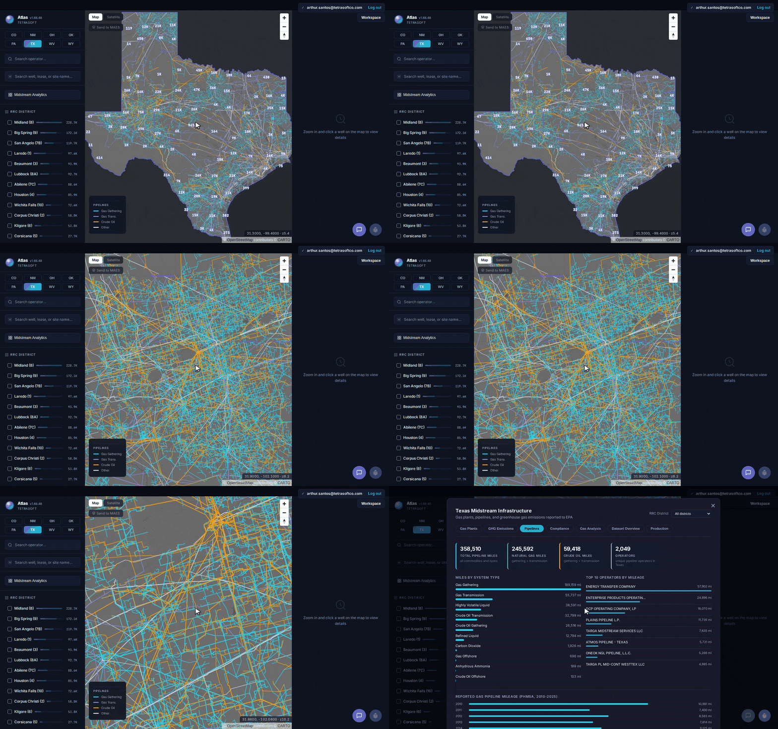
A natural gas pipeline map in Atlas, color-coded by commodity, from the statewide Texas network down to the Permian core and the operator totals. [2]
What a Natural Gas Pipeline Map Shows: Gathering vs Transmission
A good pipeline map colors each line by commodity so the type of pipe is legible at a glance [1]. Gas gathering lines read cyan, gas transmission reads indigo, and crude systems read amber [1]. The Texas layer alone holds over 480,000 individual line segments [2].
Gathering lines and transmission lines do different jobs. Gathering moves gas from the wellhead toward processing, while transmission carries it long distances between hubs. The distinction matters when you are routing a tie-in or scoping a right-of-way.
The whole network loads at every zoom level, so the lines stay sharp from a statewide view down to a single lease [1]. On the Texas map, the densest cover sits in the Permian Basin around Midland and Odessa [2]. Permian output growth is covered in Southern Permian oil in 2024.
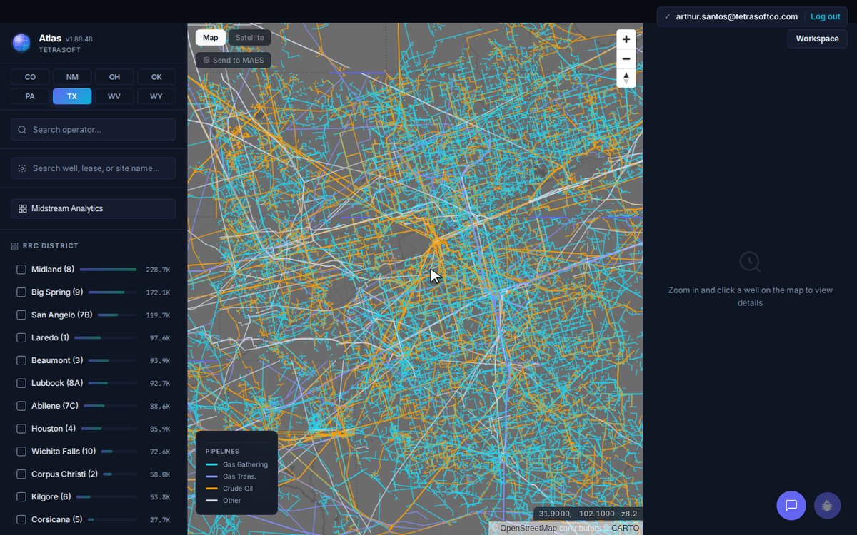
The Permian core near Midland: cyan gathering lines feeding indigo transmission trunks, each one clickable. [2]
How to Read Operators and Mileage on a Pipeline Map
The most useful pipeline maps total the network and rank its operators. Atlas does this in a Midstream Analytics dashboard beside the map [1]. For Texas, the dashboard reports about 358,510 total miles, of which 245,592 carry natural gas and 59,418 carry crude [2]. The figures reflect the current dataset and update at each monthly refresh.
Most of that mileage is not the big transmission trunk you might picture. Gas gathering alone runs 189,159 miles, while gas transmission runs 55,737 miles [2]. Gathering pipe outruns transmission pipe by more than three to one.
Crude and liquids lines add tens of thousands of miles of their own [2]. Crude oil accounts for 32,799 transmission miles plus 26,516 gathering miles [2]. Beyond crude, highly volatile liquid lines cover 38,591 miles, with another 12,794 miles of refined-product pipe [2].
A good map shows who owns each line. Energy Transfer Company leads Texas by a wide margin at 57,902 miles [2]. Enterprise Products follows with 24,896 miles, and DCP Operating Company holds 18,070 miles [2]. Plains Pipeline and Targa Midstream follow [2].
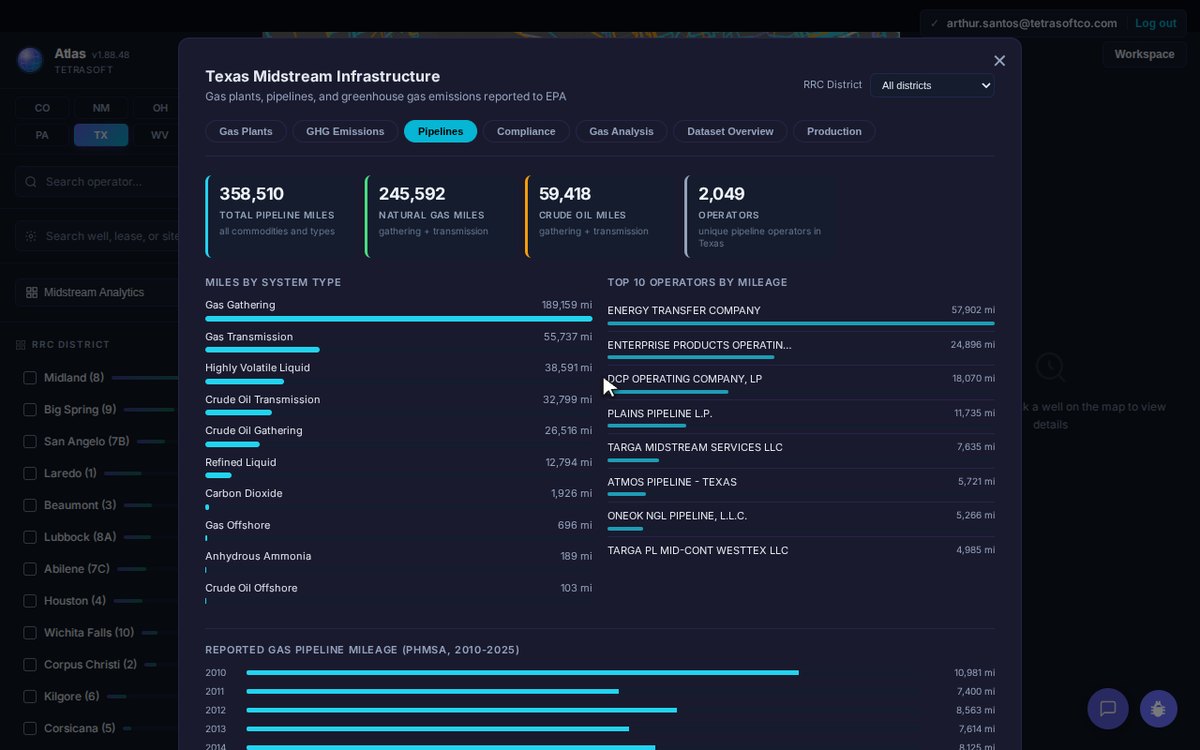
The dashboard behind the map: total mileage, miles by system type, and the top operators, all from RRC records. [2]
How to Check Pipeline Safety and Incident History
The safety record on a pipeline map comes from PHMSA, the federal pipeline regulator [3]. Atlas attaches it to the Texas network in the same dashboard [1]. PHMSA logged 1,292 Texas pipeline incidents from 2010 through mid-2026 and classified 824 as significant [3].
The incidents caused 17 fatalities and 54 injuries over the period [3]. PHMSA rated 34 of the significant incidents serious, meaning a fatality or a hospitalization [3]. PHMSA records put the total reported cost near 80.1 million dollars [3].
Atlas also charts PHMSA’s reported gas pipeline mileage year by year, from 2010 to 2025 [3]. The annual reports separate interstate from intrastate mileage [3]. The counts cover records available as of July 2026 and grow as PHMSA posts new incidents.
Reading the safety record next to the network is what turns a line on a map into a risk picture. The pipeline map covers Texas today, the one state with the line network wired into Atlas. Atlas maps other oil and gas data for more states, including the Colorado oil and gas map.
Frequently Asked Questions
Where can I find a natural gas pipeline map?
TetraSoft Atlas hosts an interactive natural gas pipeline map you can pan, zoom, and filter [1]. It draws the lines from the Railroad Commission of Texas and joins federal PHMSA safety records to them [2]. Public agencies publish the raw data, but rarely as one connected map. The pipeline map covers Texas today, and is the state to open for the full line network.
Is a natural gas pipeline map free to use?
Every Atlas plan starts with a seven-day free trial, and you can cancel anytime [1]. The trial opens the full pipeline map, its commodity filter, and the Midstream Analytics dashboard [1]. Pricing after the trial scales by team size, not by how much data you pull [1]. For current plans, see the Atlas pricing page [1].
Does the map include crude oil and liquids pipelines?
The map is not limited to natural gas lines [1]. The Texas layer also carries crude oil transmission and gathering, highly volatile liquid lines, and refined-product lines [2]. The commodity filter lets you show any one of those on its own [1]. Crude and liquids together run tens of thousands of miles across the state [2].
How current is the pipeline data?
Atlas refreshes the Texas dataset monthly and defaults to the latest records [1]. The pipeline geometry follows the Railroad Commission of Texas GIS releases [2]. The safety totals follow PHMSA’s reported incidents, current through mid-2026 [3]. A search returns the current dataset [1].
A natural gas pipeline map is most useful when the lines, the operators, and the safety record sit together. Atlas puts them on one screen, color-coded and searchable, with Texas live now [1]. Start your free 7-day trial.
References
- TetraSoft Atlas, Texas natural gas pipeline dataset and product features. https://tetrasoftco.com/atlas-landing.html#pricing
- Railroad Commission of Texas (RRC) public pipeline GIS records, as surfaced in TetraSoft Atlas.
- U.S. Department of Transportation, Pipeline and Hazardous Materials Safety Administration (PHMSA), pipeline incident and annual mileage reports, as surfaced in TetraSoft Atlas.
This post is for informational purposes only and does not constitute legal or compliance advice. Consult qualified legal counsel or a compliance professional for guidance specific to your operations and jurisdiction.
Comments
0Share your thoughts. All comments are moderated before appearing.
No comments yet. Be the first to share your thoughts!