Oklahoma sits on one of the most closely watched earthquake catalogs in the United States, with nearly 28,000 recorded events inside the state since 1980. The Oklahoma Geological Survey records the great majority of them, and 3,105 reached magnitude 3.0 or larger. The state was quiet before 2009, then the rate climbed for six years and has fallen since. USGS attributes the surge to wastewater disposal rather than to hydraulic fracturing [1]. Every one of those events maps in TetraSoft Atlas, a subscription data platform, beside the injection wells that share the same ground [2].
Quick Answer: Oklahoma’s catalog holds 27,747 earthquakes inside the state since 1980, 3,105 of them magnitude 3.0 or larger. The largest was a magnitude 5.8 near Pawnee on 3 September 2016. USGS states that most Oklahoma earthquakes are caused by wastewater disposal, not by fracking [1]. TetraSoft Atlas maps the events and the disposal wells on one screen [2].
Where Oklahoma’s Earthquakes Cluster
The events concentrate in a band across north-central Oklahoma rather than spreading evenly. Grant County carries the largest count at 4,372 recorded events. Logan County follows with 2,835 and Alfalfa County with 2,028. Oklahoma, Noble, Garfield, and Woods counties each carry more than 1,700.
The catalog itself is a state record rather than a federal one. OGS monitors, documents, and investigates seismicity across the state [3]. It supplies the great majority of the magnitudes, with the rest carrying USGS values.
The catalog also extends past the state line into southern Kansas, because the seismicity does not stop at the border. The Oklahoma map draws the events inside the state, so the catalog is the wider of the two.
That matters when you compare Oklahoma against another state, because catalogs differ in how small an event they record. The magnitude 3.0 threshold is the one that travels between catalogs.
Magnitude thins out quickly toward the top of the scale. Only five events reached magnitude 5.0 or larger in the whole catalog. The magnitude 5.8 near Pawnee in September 2016 is the largest on record, followed by a magnitude 5.7 in Lincoln County in November 2011. A magnitude 5.1 struck Lincoln County again in February 2024, so the tail has not gone quiet.
Depth is the other number worth reading off the catalog. Oklahoma’s events are shallow, with a median depth of 5.4 kilometers. Some 98 percent of the events carrying a depth sit at 10 kilometers or less. The Pawnee event was recorded at 5.6 kilometers, close to the catalog median.
The Surge Rose Over Six Years, Then Fell
Across the 29 years from 1980 through 2008, Oklahoma recorded 45 earthquakes at magnitude 3.0 or larger, then 901 in 2015 alone. The magnitude 3.0 counts show that change more clearly than the totals do.
That single year holds twenty times the magnitude 3.0 events of the previous three decades combined. USGS puts the surge in national terms: the state’s rate of magnitude 3 and larger earthquakes “exceeded California’s from 2014 through 2017.” [1]
The peak was a plateau rather than a spike. The catalog records 4,422 events in 2014, 7,607 in 2015, and 4,618 in 2016 before the decline sets in. The fall is then steady rather than abrupt, running through 2,377 in 2017 and 992 in 2019. By 2025 the count reaches 153, close to the pre-surge order of magnitude.
The damaging end of the scale follows the same arc. Of the 86 events at magnitude 4.0 or larger, 74 fall between 2009 and 2018.
What USGS Attributes the Surge To
USGS attributes the surge to wastewater disposal rather than to hydraulic fracturing [1]. That is not the mechanism most public discussion names. “The majority of earthquakes in Oklahoma are caused by the industrial practice known as ‘wastewater disposal’,” the agency states [1]. It adds that “few of these earthquakes were induced by fracking.” [1]
The agency names a magnitude 3.6 in 2019 as the largest known to be induced by hydraulic fracturing in the state [1].
The distinction rests on what is being injected. USGS notes that in Oklahoma “over 90% of the wastewater that is injected is a byproduct of oil extraction process and not waste frack fluid.” [1] Produced water, not fracturing, is the volume that matters here.
Atlas Puts the Quakes and the Injection Wells on One Map
TetraSoft Atlas maps the Oklahoma earthquake catalog as a map layer beside the state’s injection wells [2]. The same view carries 10,003 permitted UIC wells drawn from Oklahoma Corporation Commission records. A separate overlay isolates the Arbuckle injectors, the deep disposal interval at the center of the state’s seismicity work. You can switch both on during a free trial and read the two datasets against each other [2].
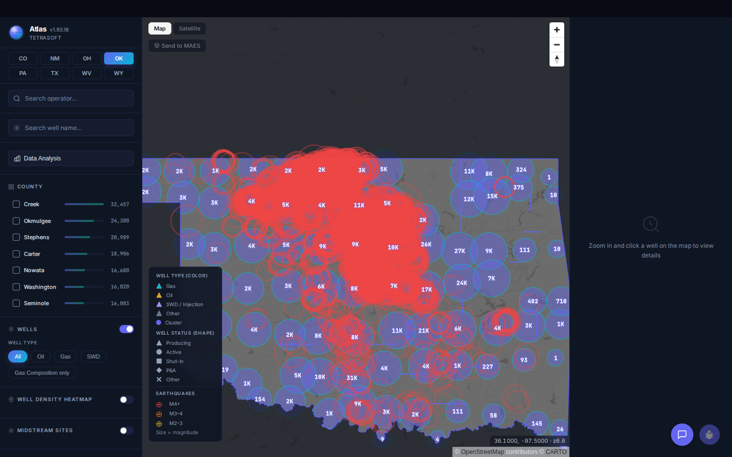
The Oklahoma earthquake catalog as a map layer, with the injection-well overlays listed beside it. The map draws a sample of the catalog at statewide zoom.
Spatial Overlap Does Not Prove Cause for Any Single Event
Proximity on a map is not proof of cause for any single event.
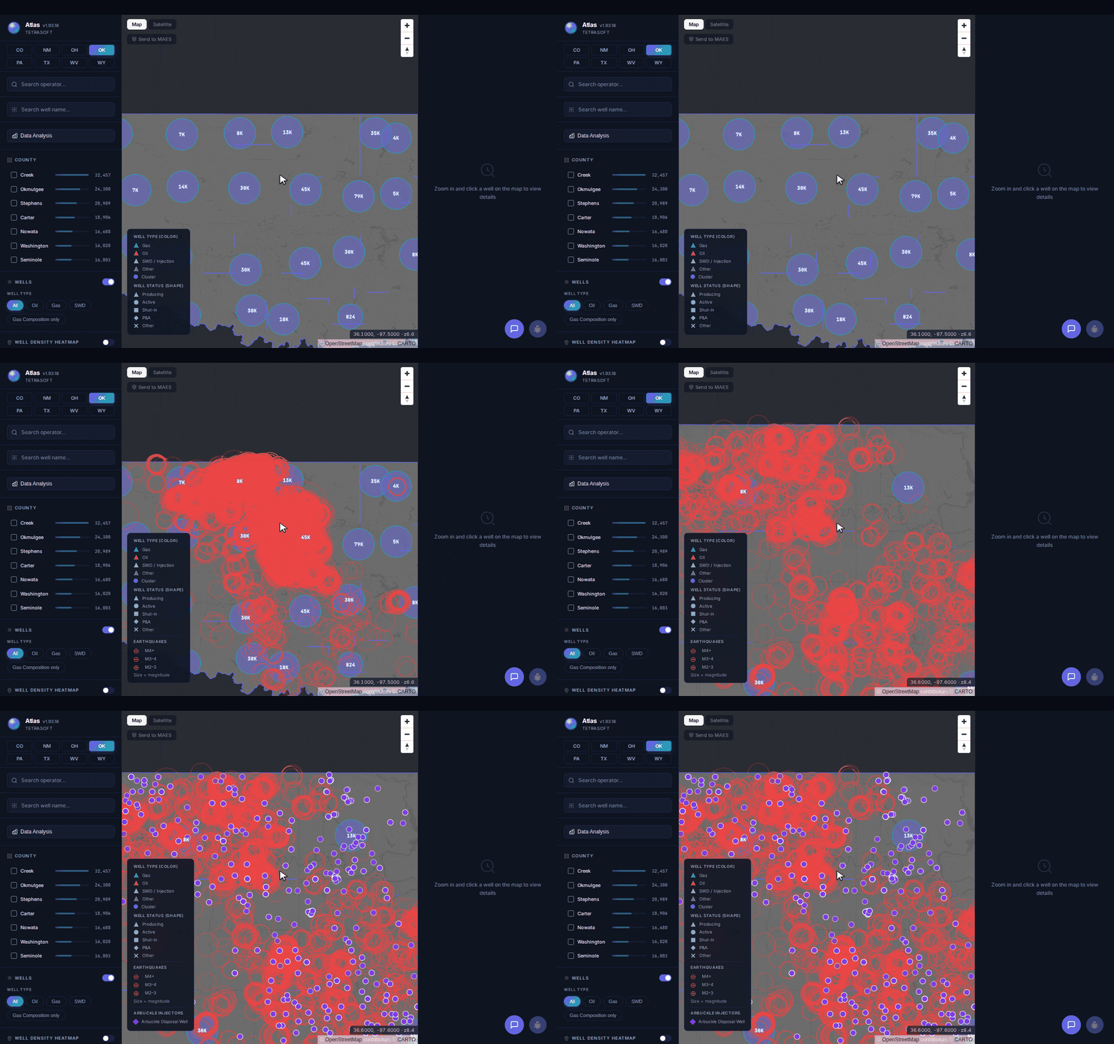
The earthquake catalog first, then the Arbuckle disposal wells switched on beneath the same events.
The causal finding here belongs to USGS and the seismology literature, not to a map overlay. What the map does give you is the geography: which counties carry the events, and which disposal wells sit in the same townships [2].
Oklahoma’s broader well and permit records are walked through in the OCC Oklahoma oil and gas guide. Every state record is keyed to the well’s API number. The API well number lookup guide explains how to read one.
Frequently Asked Questions
How many earthquakes has Oklahoma had?
Oklahoma has 27,747 recorded earthquakes inside the state since 1980. Of those, 3,105 reached magnitude 3.0 or larger, roughly one event in nine. The rest are generally too small to be felt at the surface.
What was Oklahoma’s largest earthquake?
The magnitude 5.8 near Pawnee on 3 September 2016 is “Oklahoma’s largest recorded earthquake to date.” [4] Researchers also rank it as “the largest earthquake to have been induced by wastewater disposal” anywhere [5]. Its rupture began shallow and moved upward, then slipped deeper than most induced seismicity in the region [5]. Four other Oklahoma events have reached magnitude 5.0, two of them in Lincoln County.
Does fracking cause Oklahoma’s earthquakes?
USGS says few of them were induced by fracking [1]. Oklahoma’s regulator puts the fracking-linked share at “less than 4 percent of the earthquake activity,” in generally smaller events [6]. Most disposed water comes from producing wells rather than fracking, rising to the surface with the oil and gas [6]. Commission volume limits cut disposal in earthquake areas by roughly 800,000 barrels a day from 2014 levels [6].
Are Oklahoma earthquakes still happening?
Yes, and the most recent event in the catalog is dated 14 March 2026. The annual count now runs at a small fraction of the 2015 peak.
How much does Atlas cost?
Atlas offers three plans, from individual analysts to large operator teams. All paid plans include a 7-day free trial, and canceling before day 7 costs nothing [2]. For current plans and prices, see the Atlas pricing page [2].
Oklahoma’s earthquake record is a public dataset, and it reads very differently next to the injection wells than it does alone. Atlas puts both on one map, refreshed monthly from state records [2]. Start your free 7-day trial.
This post is for informational purposes only and does not constitute legal or compliance advice. Consult qualified legal counsel or a compliance professional for guidance specific to your operations and jurisdiction.
References
- United States Geological Survey (USGS), Oklahoma has had a surge of earthquakes since 2009. Are they due to fracking? https://www.usgs.gov/faqs/oklahoma-has-had-a-surge-earthquakes-2009-are-they-due-fracking
- TetraSoft Atlas, Oklahoma oil and gas dataset and product features. https://tetrasoftco.com/atlas-landing.html#pricing
- Oklahoma Geological Survey (OGS), Earthquakes research and seismic monitoring program. https://www.ou.edu/ogs/research/earthquakes
- United States Geological Survey (USGS), Magnitude 5.8 Earthquake in Oklahoma. https://www.usgs.gov/news/featured-story/magnitude-58-earthquake-oklahoma
- Moschetti, M.P., Hartzell, S.H., and Herrmann, R.B., 2019. Rupture model of the M5.8 Pawnee, Oklahoma earthquake from regional and teleseismic waveforms. Geophysical Research Letters. https://doi.org/10.1029/2018GL081364
- Oklahoma Corporation Commission, Earthquake Response Summary, 30 May 2018. https://oklahoma.gov/content/dam/ok/en/occ/documents/ajls/news/2018/05-30-18earthquakeactionsummary.pdf
Comments
0Share your thoughts. All comments are moderated before appearing.
No comments yet. Be the first to share your thoughts!